BASIC PROJECT DATA
Project ID: PA1A013
NEED AND ADDED VALUE FOR THE DANUBE REGION STRATEGY
One of the main activities of EAEMDR – Ruse is the maintenance of the fairway in the section from Somovit (rkm 610) to Silistra (rkm 375) with a total length of 235 rkm. EAEMDR is also responsible for the maintenance of the coastal (navigational) signalling on the Bulgarian bank in the entire common Bulgarian- Romanian section – from Timok river (rkm 845) to Silistra (rkm 375) with total a length of 470 rkm.
The signalling of the waterway is implemented by installing floating navigational signs and coastal navigational signs (situated on the riverside or on islands) which indicate dangers for navigation, conditions for access or denied access or have indicative character, etc.
The floating signs were controlled weekly and changes were made every three days, if necessary. The signals were not equipped with sensors and due to this fact it was not possible for the operative office of EAEMDR to control their location from distance in real time. It often happened that signals were relocated or lost because of passing vessels (convoys). In this case, the respective section remained without signals until the next specialized vessel for waterway maintenance passed by. This situation was unfavourable for the safety of navigation. In other cases the accumulators of the lighting signals were taken without permission and thus the meaning of the floating signal was changed. This was unfavourable for the safety of navigation as well.
The project Improvement of the navigational systems and topo-hydrographic measurements on the Danube River was implemented during the first programming period 2007-2013 under the Bulgarian Operational Programme on Transport. Within the project a new control GPS geodetic network was established along the Bulgarian section of the Danube River. The network serves as a base for carrying out geodetic and hydrographic activities with modern GPS technologies in studying the changes in the riverbed. Beside this, another project result was the installation of 9 automatic hydrometric stations and 9 meteorological stations along the Bulgarian section of the river, including electronic information boards, which increase the awareness of the skippers and other stakeholders about the current hydro-meteorological situation on the Danube in real time.
The safety of navigation was improved through the delivery of 160 new floating signal (buoys) equipped with lights for better visibility, including device and sensors for monitoring and tracking their location in real time, as well as the operational status of the lamp and its power. In addition, the coastal signs along the riverbank were exchanged for new ones and a system for real time monitoring and control of the navigational signs was implemented.
OBJECTIVE(S) OF THE PROJECT
The general objective of the project was to ensure better navigational conditions and safety of navigation through improvement of the navigational systems and the topo-hydrographical measurements in the Bulgarian section of the Danube River, part of the TEN-T Rhine-Danube Corridor. This was achieved through the implementation of the following specific objectives:
- Modernisation of the monitoring networks and the methods for collecting, processing and analysing data for the quantitative assessment of the Danube waters in compliance with the requirements of the WMO, the Danube River Protection Convention, Water Framework Directive and ICPDR.
- Achievement of the international standards for implementation of topographic (geodetic) measurements, together with hydrological and hydrographical activities, necessary for studying the changes of inland waterways according to the requirements of the national legislation.
- Unification and improvement of the quality of marking the navigational waterway along the common Romanian-Bulgarian section of the Danube River.
- Decreasing the time for providing information to the stakeholders and improvement of the quality of service.
- Rehabilitation and improvement of the basic infrastructure of the geodetic control network along the Danube River.
CONDUCTED PROJECT ACTIVITIES
The following activities were implemented within the project:
Activity 1 – Establishment of GPS geodetic control network on the Bulgarian bank of the Danube – it serves as a basis to carry out topo-hydrographic and hydrological surveys in the common Bulgarian- Romanian section of the river. The control network is also a basis for carrying out river engineering measures in the common section – construction facilities such as quay walls, bank strengthening, etc.
Activity 2 – Delivery and installation of 9 automatic hydrometric stations and 9 meteorological stations along the Bulgarian section of the river, including electronic information boards. The density of the hydrometeorological network was increased which allows for the timely delivery of comprehensive data on more river sectors.
Activity 3 – Modernization of the floating and coastal signalling through delivery of new floating and coastal signals, equipped with solar panels and GPS. Remote monitoring through GSM modems and AIS transponders. Implementation of a system for real time monitoring and control of the navigational signs.
TRANSBOUNDARY IMPACT
The activities improve the safety of navigation along the joint Romanian-Bulgarian section of the Danube river so that this part of the Lower Danube is directly affected. The impact of the project can be seen on a larger scale as well, as the river is part of the Rhine-Danube corridor and due to its linear transport structure, improvement of the navigation in one river section leads to improvement of the navigation along the whole corridor as well.
PROJECT BENEFICIARIES / TARGET GROUPS
A wide range of stakeholders from different countries benefits from the project e.g. shipping companies, skippers, transport and logistics companies etc.
STATUS AND TIMEFRAME
Start date: 10/2013
End date: 09/2015
The project has been concluded.
FINANCING
Total budget: 1,773,574.61 EUR
EU funds: 1,507,538.42 EUR were funded by Operational Programme ‘Transport’ (OPT) 2007–2013 (ERDF)
National funds: 266,036.19 EUR
PROJECT TEAM
Project leader: Executive Agency for Exploration and Maintenance of the Danube River / Bulgaria
(website: www.appd-bg.org)
Address: Slavyanska Str 6, 7000 Ruse / Bulgaria
Contact person: Pavlin Tsonev
Contact data: ; +359 82 82 31 30
No additional partners were involved.
PROJECT ENVIRONMENT
PROJECT CROSS – REFERENCE
Follow-up project: Improvement of the navigational systems and topo-hydrographic measurements on the Danube River – Phase 2 (PA1A121)
STRATEGIC REFERENCE
The implementation of the project significantly supported the Bulgarian authorities in the process of adopting the EU standards and helped the application of the EU legislation in the field of inland waterway navigation management.
It increases the safety of IWW transport and will support the implementation of the river basin management plans.
The project is in line with the following strategies / policies:
- Operational Programme on Transport 2007-2013, Priority axis 4 Improvement of the navigational conditions on the maritime and inland waterways
- Strategy for development of the transport system of Bulgaria till 2020
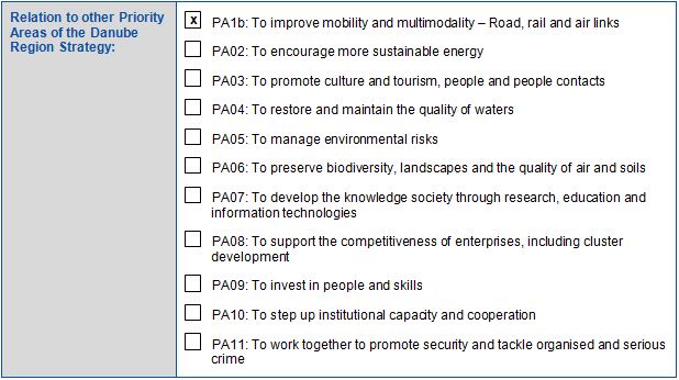
- EU Strategy for the Danube Region, Priority Area 1A – To improve mobility and multimodality: inland waterways
- The Transport White Paper
- TEN-T guidelines
- NAIADES and NAIADES II action programmes of the European Commission
- The Fairway Rehabilitation and Maintenance Master Plan, endorsed by the Danube Ministers of Transport on 3rd December 2014
RELEVANT LEGISLATION
- Convention Regarding the Regime of Navigation on the Danube,1948, Belgrade
- Agreement between the Governments of the Republic of Bulgaria and the Romanian Republic for maintenance and improvement of the fairway in the common Bulgarian-Romanian section of the Danube River, 1955
- Recommendations of the Danube Commission (DC) and the European Commission for Economics with the UN (UN ECE) in the context of the Convention of the regime for navigation on the Danube River from 1948, Belgrade.
- Law on sea waters, inland waterways and ports of the Republic of Bulgaria
- Regulation (EU) No 1315/2013 of the European Parliament and of the Council of 11 December 2013 on Union guidelines for the development of the trans-European transport network, obliging EU Member States to preserve a good navigation status, while respecting the applicable environmental law
EUSDR EMBEDDING
EUSDR COMPLIANCE
META DATA
Data provided by: Tsvetelina Pastir (EAEMDR, Bulgaria) – 14.09.2011
Last update: Veneta Popova (EAEMDR, Bulgaria) – 24.01.2017
Download pdf