BASIC PROJECT DATA
Project ID: PA1A026
NEED AND ADDED VALUE FOR THE DANUBE REGION STRATEGY
According to the recommendations of the Danube Commission, minimum 2.5 m fairway depth must be ensured on this sector, whereas the width of the navigable fairway should be in the range of 150 to 180 m. Due to the regressing evolution of the main Danube branch in the low water seasons, eleven critical points for navigation have appeared:
- Caragheorghe (rkm 345 – 342)
- Lebăda (rkm 341 – 336)
- Mîrleanu (rkm 329 – 325)
- Insula Fermecatu (rkm 323 – 318)
- Cochirleni (rkm 310 – 307)
- Insula Fasolele (rkm 292)
- Alvăneşti (rkm 276)
- Ostrovul Lupu (rkm 196) and others.
As a consequence of these critical points on the Călăraşi – Brăila section of the Danube, vessels must take a bypass route via the Bala–Borcea branch, which extends the navigation distance to around 110 km, for periods of around 140 – 160 days/ year.
This is a situation caused by the involution of the main Danube riverbed and the overdevelopment of the Bala and Borcea branches upstream. Therefore, discharge has increased on the Bala branch to almost 80% of the Danube’s discharge. The continuous decrease in the discharge of the Danube in Cernavodă resulted in the formation and development of the above mentioned bottlenecks and the appearance of other risks, which resulted in the discontinued use of the Cernavodă Nuclear Plant in 2003.
A feasibility study for the project was completed in 2006 and was worth 1.64 million EUR (ISPA funding and the state budget). According to the feasibility study, the estimated amount for the necessary works was set at 56 million EUR. In April 2009 the contract for the execution of the works at three out of the eleven critical points was signed. The construction site was organized and the construction materials were purchased, whereas on 26 January 2010 works had to be suspended, pending the approval by the European Commission of the second installment of the advance payment according to the Financing Memorandum.
OBJECTIVE(S) OF THE PROJECT
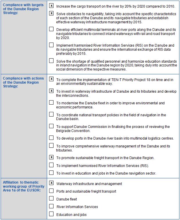
To ensure navigation conditions on the Danube all year round.
PLANNED PROJECT ACTIVITIES
The project includes the following river engineering works which will ensure navigation levels on the Old Danube and have a reduced impact on the environment, having effects only during low water seasons:
- Submersed bottom sill on the Bala branch, with a view to recreating its opening and decrease the discharge on it and increase discharge by up to 20% on the Danube
- Submersed guiding wall
- Banks protection
- Submersed bottom sill on the Caleia branch, with a view to stopping its development and recreate the Danube riverbed upstream.
TRANSBOUNDARY IMPACT
This sector of the Danube is used for navigation by vessels flying all kinds of flags. At rkm 300 (Cernavodă) is the entrance on the Danube–Black Sea Canal.
PROJECT BENEFICIARIES / TARGET GROUPS
Shipping companies.
STATUS AND TIMEFRAME
Restarting date: August 2011
End date: t.b.d.
The project is currently ongoing.
NOTES
The project is in delay (19 months). The works were stopped in January 2009 due to the intervention of NGOs and the European Commission’s DG Environment. Based on this, DG Regional Policy recommended to implement a complex programme for monitoring the impact of the works on biotic and abiotic factors in all the critical points. Consequently, the Romanian Ministry of Transport organised a tendering procedure for preparation of this Monitoring Programme. Due to the contribution of and recommendations received from EC-DG Environment, ICPDR and IAD experts, the Monitoring Programme has been substantially improved and is now implemented by the River Administration of the Lower Danube – Galati within the project “Monitoring of Environmental Impact of the Works for Improvement of the Navigation Conditions on the Danube between Calarasi –Braila, km 375 – km 175”.
Based on the EC recommendation, the project was transferred from ISPA funding to Operational Program Transport 2007-2013 funding.
In October 2013, a meeting was organised by the Ministry of Transport with all stakeholders, at which the 3D modelling expert, Prof. Habersack, presented the results obtained after running the 3D model under the Environmental Monitoring Contract. Therefore, AFDJ together with the Ministry of Transport and EC – DG Regio, DG Move and DG Environment decided to reduce the initially designed crest level of the submersed bottom sill to be executed on the Bala branch by 50%.
The contractor had been notified to resume the works beginning with 22 August 2011.
In July 2014 the contractor finished the works in critical point 10 “Caleia” and in November 2015 the works were also finished in critical point 02 “Epurasu”.
The works in critical point 01 “Bala” were finished in April 2016.
In order to achieve the deviation of water discharge from Bala branch to the Danube other alternative solutions are needed in the area. These solutions are to be identified in a Feasibility Study which started in March 2015. The alternative solutions together with the works already executed in critical point 01 “Bala” have to ensure a deviation of water discharge from Bala branch to the Danube. Within the Feasibility Study the consultants proposed several alternative technical solutions in order to ensure the minimum depth on the Danube during the dry season. Several scenarios were prepared and presented during a workshop with the stakeholders which took place in October 2015. Presently, the consultant has drafted the 3D modelling report recommending one technical solution in order to solve the navigability problem in this critical point. AFDJ is analysing this solution in order to approve it. Further to the approval of this technical solution, the additional environmental information will be collected for the main scenario and an Environmental Impact Assessment will be started. In 2018, the technical documentation for works implementation is planned to be prepared.
FINANCING
Total budget: 47,840,000 EUR
EU funds: 38,260,000 EUR
The project was first funded by the Structural Pre-Accession Instrument (ISPA).
2010 it was transferred to the Operational Programme `Transport´ (SOPT) 2007 – 2013 (CF, ERDF).
Currently, the project is funded by the Operational Programme for Large Infrastructure in Romania (POIM) 2014 – 2020 (CF, ERDF).
National funds: 9,580,000 EUR
PROJECT TEAM
Project leader: River Administration of the Lower Danube (AFDJ), Galati
(website: www.afdj.ro)
Address: Portului Street no. 32, Galati / Romania
No additional partners are involved.
PROJECT ENVIRONMENT
PROJECT CROSS – REFERENCE
Monitoring of environmental Impact of the works for Improvement of the navigation conditions on the Danube between Călăraşi – Brăila, km 375 – km 175 (ROMOMED Project)
STRATEGIC REFERENCE
- Strategy for sustainable development on the period 2007-2013 and 2020, 2030 approved by Minister of Transport Order no. 508/2008
- Government Programme 2009 – 2012
- Belgrade Convention (1948)
- Navigation and Inland Waterway Action and Development in Europe (NAIADES) COM (2006) 6 final
- White Paper Roadmap to a Single European Transport Area – Towards a competitive and resource efficient transport system COM(2011) 144 final
RELEVANT LEGISLATION
- Decision No 661/2010/EU of the European Parliament and of the Council of 7 July 2010 on Union guidelines for the development of the trans-European transport network
- Low no. 203/2003 regarding the guidelines for the creating, development and modernization of transport network of national and international importance
- All EU Directives related to Environmental Protection
EUSDR EMBEDDING
EUSDR COMPLIANCE
META DATA
Data provided by: Cristina Cuc, Monica Patrichi (Ministry of Transport and Infrastructure, Romania) – 13.09.2011
Last update by: Catalina Dumbrava (River Administration of the Lower Danube –Galati, Romania) – 19.01.2017
Download pdf
)